

National Seismological Center

The earth shakes.
You know first.

Larzeh-bin pulls data from seismograph stations across the country within the first seconds and shows you the magnitude, depth, distance, and exact location of every earthquake — instantly, on your phone and in your browser.

Sample seismograph trace Recording
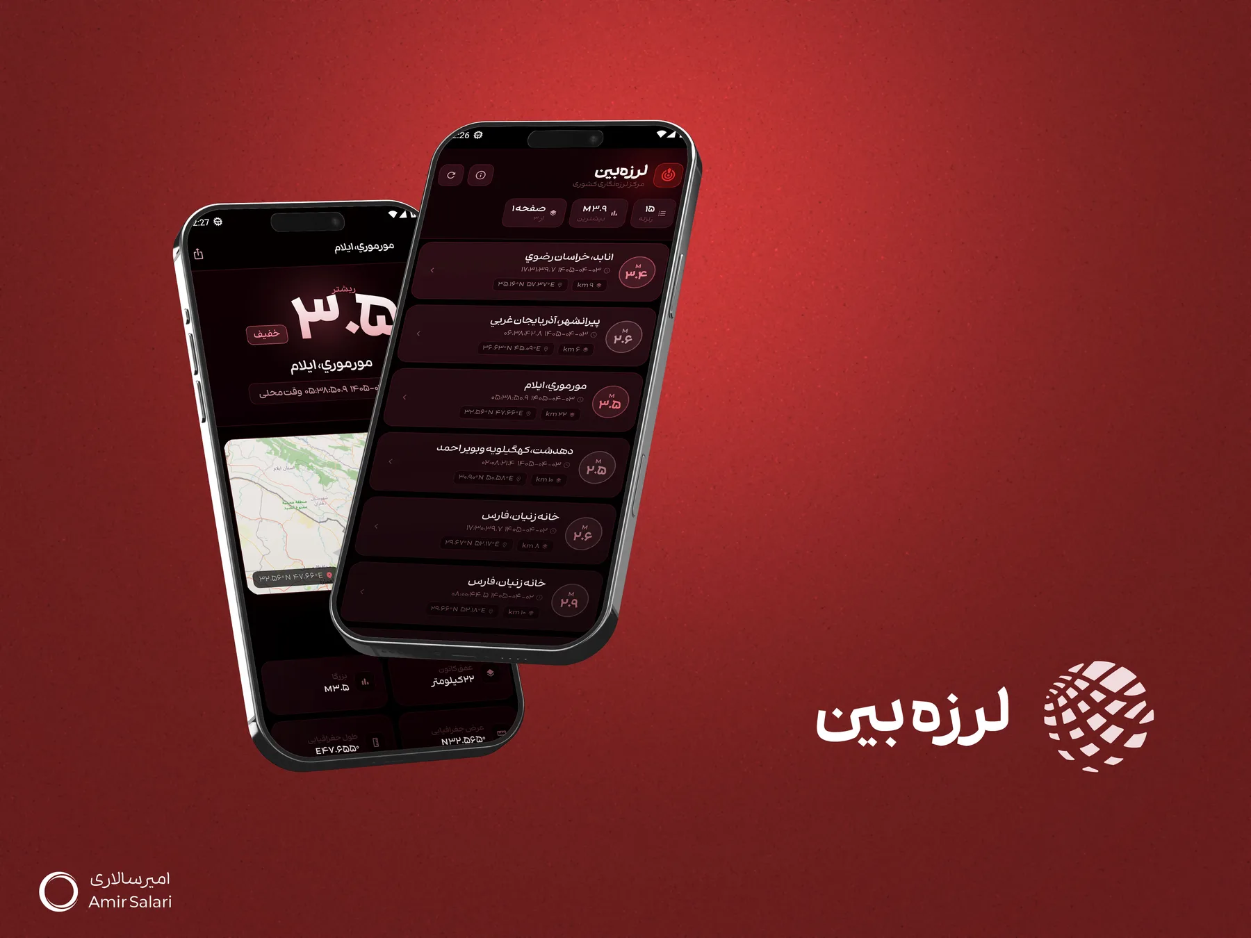
Earthquake magnitude display in the Larzeh-bin app, Iran's earthquake monitoring software
M 3.9 Highest today
15 earthquakes recorded
Event Feed

Every event, in full detail

For every earthquake, see the region name, magnitude, depth, and exact time at a glance.

Mormori, Ilam
2026/06/24 — 09:58:38 local time
5.3Richter
Depth 9 kmLight
Anabad, Razavi Khorasan
2026/06/24 — 17:31:39
3.9Richter
Depth 9 km35.16N 57.37E
Piranshahr, West Azerbaijan
2026/06/24 — 06:42:18
3.6Richter
Depth 7 kmLight

A sample of how events appear in the app — real data updates live after installation.

Features

Everything you need to stay informed

From the moment it happens to the full archive, Larzeh-bin makes earthquake awareness simple.

Instant Alerts

The moment an earthquake is recorded anywhere in the country, you get a push notification directly on your phone.

Precise Magnitude & Depth

For every event, see the Richter magnitude, focal depth, and distance from your location.

Map & Coordinates

View the exact location of every earthquake on a map, along with its geographic coordinates.

Complete Event Archive

A searchable, paginated history of every earthquake recorded across the country.

Quick Sharing

Share the details of any earthquake with family and friends in a single tap.

Web Version Included

No installation needed — access the same data from your browser, on any device.

Real-time list of earthquakes in Iran and Tehran in the Larzeh-bin app

One glance, all the information

The list of recent earthquakes, map, depth, and coordinates — all on one simple, readable screen.

Dashboard

Simple to see, precise to know

The Larzeh-bin dashboard ranks recent events so the most important information is always within reach.

Turn alerts on or off

Toggle instant notifications on or off with a single tap.

Highest magnitude of the day

The strongest earthquake recorded recently always stays at the top of the screen.

Browse page by page

Review the event list with simple, clutter-free navigation.

National Seismological Center dashboard in the Larzeh-bin app, showing the latest earthquakes
Earthquakes in Iran & Tehran

Why does earthquake monitoring in Iran matter?

Iran is one of the most seismically active countries in the world, and understanding this risk is the first step toward preparedness.

Iran, on the world’s seismic belt

Iran sits on the Alpine-Himalayan seismic belt, the same belt that makes cities like Istanbul and Tokyo earthquake-prone. Hundreds of active and inactive faults are scattered across the country, making earthquakes a relatively frequent occurrence. Over the past century, earthquakes such as Buin-Zahra (1962), Tabas (1978), Rudbar-Manjil (1990), Bam (2003), and Ezgeleh-Sarpol-e Zahab (2017) have been among the most destructive events in Iran’s earthquake history.


Earthquakes in Tehran: the Mosha, Rey, and North Tehran faults

Tehran lies close to several active faults, including the North Tehran fault, the Mosha (Fasham) fault, and the Rey fault. According to researchers at the International Institute of Earthquake Engineering and Seismology, these faults have historically produced earthquakes above magnitude 7 — which is why real-time earthquake monitoring in Tehran matters so much for residents of this metropolis.

What does Iran’s National Seismological Center do?

Iran’s National Seismological Center and the Institute of Geophysics at the University of Tehran operate a network of seismograph stations across the country, recording and processing ground vibrations to determine each earthquake’s magnitude, depth, and precise location as quickly as possible. Larzeh-bin delivers this official data to you in a simple, easy-to-understand format.

What is a seismograph and how does it work?

A seismograph (seismometer) is an instrument that records even the smallest vibrations of the earth as an oscillating line — the same line simulated live at the top of this page. The greater the amplitude of the oscillation, the higher the earthquake’s magnitude. Combining data from hundreds of seismographs across Iran makes it possible to precisely locate the epicenter of every earthquake.

Get started now

Take Larzeh-bin with you

Install it on your phone or use it straight from your browser — the data is identical and real-time in both versions.

FAQ

Frequently asked questions about earthquakes

When was the latest earthquake in Tehran?

The latest events recorded by the country’s seismograph stations, along with exact time, magnitude, and location, are displayed live in the Larzeh-bin app and web version.

Why do Iran and Tehran experience so many earthquakes?

Iran lies on the Alpine-Himalayan seismic belt and is crossed by numerous active faults. Tehran itself sits near the North Tehran, Mosha, and Rey faults, among the country’s most significant active faults.

How does a seismograph record an earthquake?

A seismograph records the movement and vibration of the earth’s crust as an oscillating line. The country’s network of seismograph stations processes this data to determine each earthquake’s magnitude, depth, and location.

What does Iran’s National Seismological Center do?

Iran’s National Seismological Center is responsible for recording, processing, and officially announcing the details of earthquakes across Iran through its network of seismograph stations.

Does Larzeh-bin have a web version?

Yes — in addition to installing the app on your phone, you can access the same real-time earthquake data through your browser, with no installation required.

This software is designed and developed by the Raya brand.

Software development: Amir Salari